 "TheRealBicycleBuck" (therealbicyclebuck)
02/17/2019 at 21:57 ē Filed to: None
 6
6
 13
13
 "TheRealBicycleBuck" (therealbicyclebuck)
02/17/2019 at 21:57 ē Filed to: None |  6 6
|  13 13 |
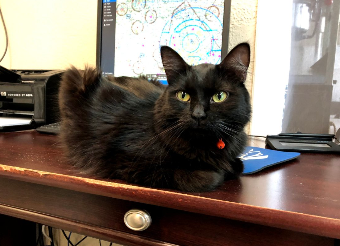
[Update] So, the rest of the flying weekend was a bust. Weather rolled in and I wasnít able to get in the air with my instructor yesterday or today. The weather cleared up this afternoon, but he was booked with other clients. At least the cat that has adopted the flight school was in feeling friendly. The maintenance guys call her Maggie, but someone stopped by Saturday morning and was calling her Whiskey.
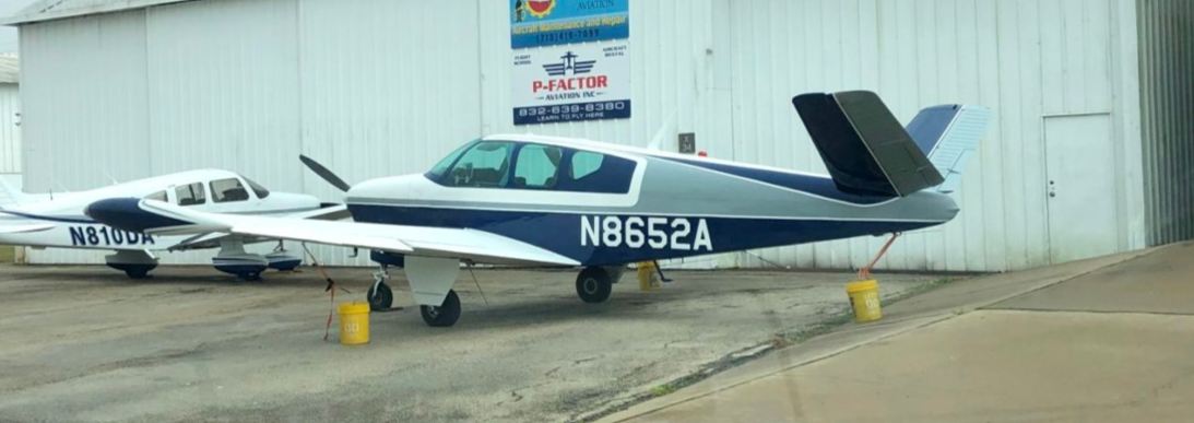
I also spotted a couple of neat aircraft. One of my favorites:
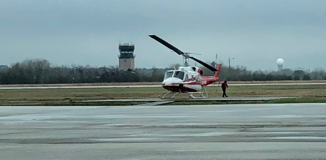
And a Huey! The cloud cover is hanging out around 900 feet AGL.
The highlight of the bad weekend was a visit to the tower. This airport is somewhat unusual because itís a public/private airport. The tower is an FAA facility even though the airport is privately owned. The controllers said they think itís set up this way because of the large number of student pilots, the proximity to Bush Intercontinental Airport, and so they can use it as a training facility for new air traffic controllers. I learned quite a bit about how it functions. Very neat!
[Original content below]
Iíve planned a weekend chock-full of flying if the weather holds. We got started with my first big cross-country trip this afternoon.
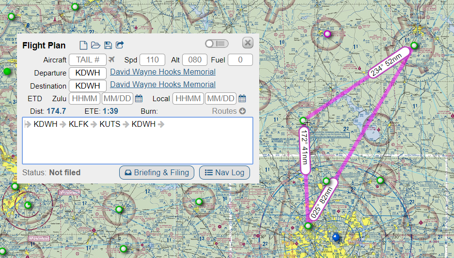
The plan was to go from David Wayne Hooks Airport to Angelina County Airport in Lufkin, TX, then to the Huntsville Airport, and finally, back to Hooks. The total trip was about 175 nautical miles or just over 201 statute miles.
When planning a trip like this, the first step is to get all of the airport information for each of the stops. Important things to note are the appropriate frequencies for communication, the runway lengths, and the weather so you know which runway to use when landing.
The next step is to use the map to identify waypoints along the way. I put together a list of things easily-identifiable from the air like the peninsula of a lake, a small town, or a small airport. Once they are compiled, the next step is to figure out the distances between each waypoint and how long it will take to reach each point given how fast your plane will fly under the current weather conditions.
This can all be done with a map, a pencil, a navigation plotter and an analog flight computer.

Or, you can cheat and use software like ForeFlight or SkyVector. For todayís flight we did a little of both. I put together the list manually, but my instructor pulled everything up on his iPad to verify I found all of the right information. We also used the GPS in the plane to mark the route between airports while I navigated between the waypoints. Itís a great fail-safe.
We got off the ground about 45 minutes before sunset. The winds were out of the west, so when we got to Lufkin, I was landing into the setting sun. That was one of the most difficult landings Iíve had to make. The sun was blinding. Thankfully, there was no traffic at that airport.
After we got airborne again, I took the only picture I would on this flight.
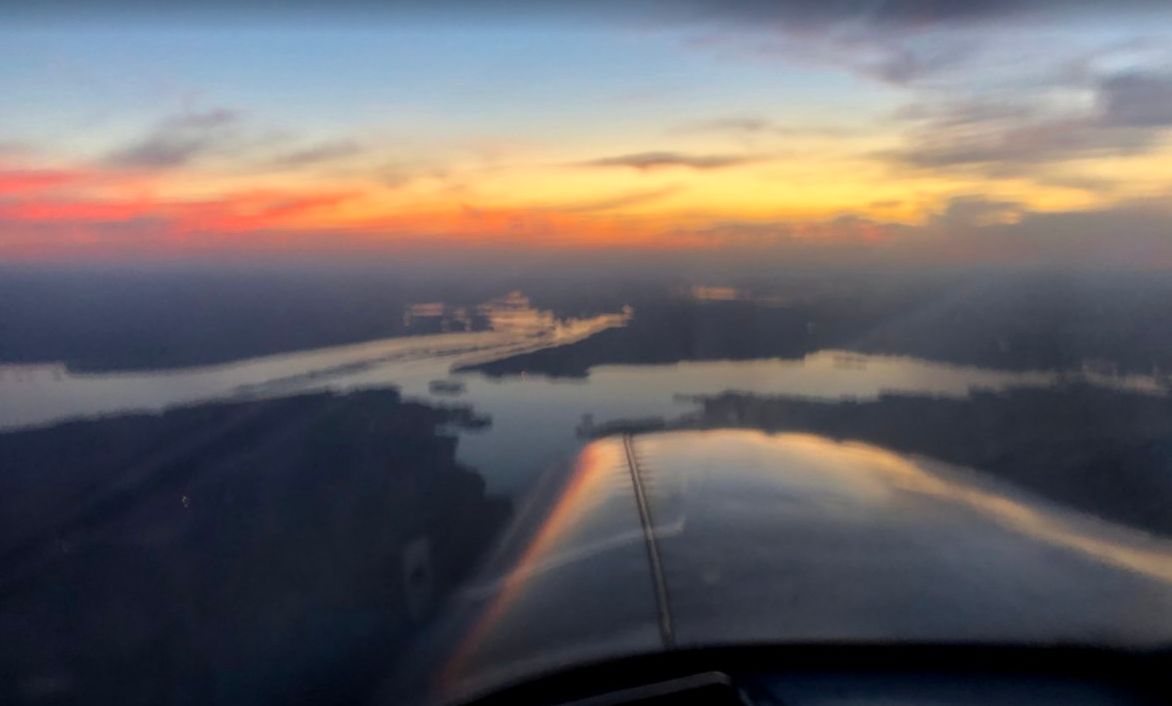
The sunset was beautiful even if the image I took was awful. Just squint your eyes a bit and youíll get the idea.
For the last two legs, we cheated a bit more. Thereís a process called flight following. The basic idea is to request guidance from the same guys who provide traffic control for the big birds. The pilot tells traffic control where he wants to go and they provide instructions. The best part is that once you contact them, they give you a specific transponder code and that is used to track your progress. Once itís being tracked, it becomes part of a public database. Hereís my flight from KLFK this evening:
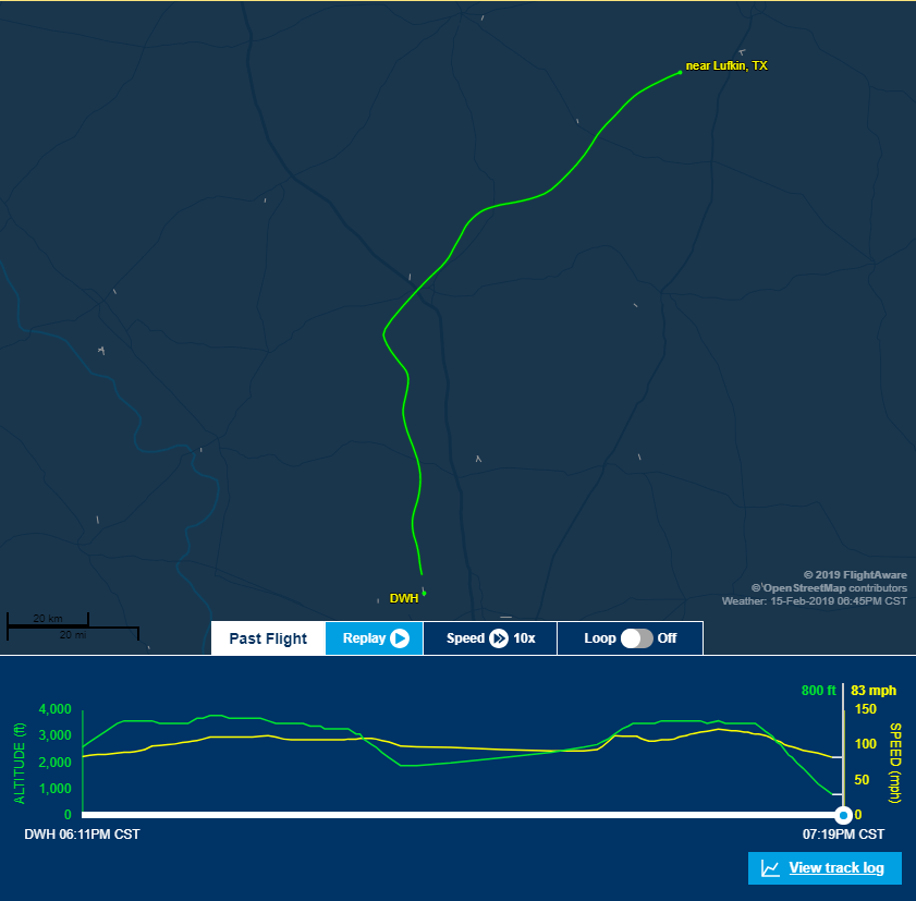
All the wiggling around was me following my VFR waypoints.
And that led to the best part! The second tier of controlled airspace is ďbravoĒ. This is where the big birds fly. You have to have permission to enter bravo airspace. If you enter it without permission, the FAA will come calling. My home airport is underneath bravo airspace, so weíre taught to drop our altitude to fly under it without getting into trouble.
Today, we were authorized to enter the bravo airspace without even asking! Coming back from Hunstville, we were cruising at 3,500'. Air traffic control told us to maintain altitude and direction and gave us permission to enter bravo. Thatís something many private pilots never get to do. I can now say I was sharing airspace with commercial jets!
I managed to make my way back to my home airport after dark with minimal assistance then land after dark on my own. We have two more long flights planned over the weekend. I just canít wait to see what we get to do tomorrow!
 WilliamsSW
> TheRealBicycleBuck
02/15/2019 at 23:20 |
|
Nice! The airport I learned at, KPWK, is only about 2 miles from Class B surface airspace at OHare , and I never entered the Class B while VFR ( though I knew an instructor who claimed to have done a touch and go at KORD late at night). Very cool!
 CarsofFortLangley - Oppo Forever
> TheRealBicycleBuck
02/15/2019 at 23:21 |
|
When are we having the first Oppo sky meet?
 TheRealBicycleBuck
> CarsofFortLangley - Oppo Forever
02/15/2019 at 23:32 |
|
Great idea! Iím planning to get together with tttyyyymmmm sometime soon after I get my certificate. We should find a central location and all fly in!
 TheRealBicycleBuck
> WilliamsSW
02/15/2019 at 23:42 |
|
Thanks! Now I have my sights set on landing at Bush Intercontinental.
I saw this video of a guy flying a Cessna (172?) into OíHare. He cheated and did it IFR. :)
 WilliamsSW
> TheRealBicycleBuck
02/15/2019 at 23:42 |
|
W I C H I T A
 TheRealBicycleBuck
> WilliamsSW
02/15/2019 at 23:44 |
|
Thatís a five-hour flight in the little 140 I fly. If I split it up, I can stay the night with friends or family in Oklahoma.
Iím in!
 WilliamsSW
> TheRealBicycleBuck
02/15/2019 at 23:49 |
|
Wichita has Doc, a bunch of aviation manufacturers and history, and a bunch of Oppos , and itís centrally located. Itís perfect.
 ttyymmnn
> TheRealBicycleBuck
02/16/2019 at 00:11 |
|
Come to Austin!†
 gmporschenut also a fan of hondas
> TheRealBicycleBuck
02/17/2019 at 22:20 |
|
A friend of my parents returning from Maine, made a quick stop in Boston at Logan at 6am on sunday. Tower ďincrease speed to 140" ďcan;t maxed outĒ ď turn to _ heading and wait for further instructions Ē
 WilliamsSW
> TheRealBicycleBuck
02/17/2019 at 22:28 |
|
Part of the deal unfortunately
Sweet Bonanza!
 Chariotoflove
> TheRealBicycleBuck
02/18/2019 at 00:03 |
|
Aw man, donít make me drive to Austin. †The traffic sucks. †Come to Dallas instead.
 TheRealBicycleBuck
> Chariotoflove
02/18/2019 at 00:15 |
|
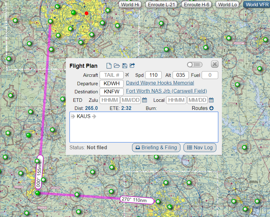
Well, I may have to make several trips! Austinís about an hour out from KDWH, Fort Worth is about an hour and half north from there....
 Chariotoflove
> TheRealBicycleBuck
02/18/2019 at 00:17 |
|
Thatís the spirit!